Overview
What the project is designed to do
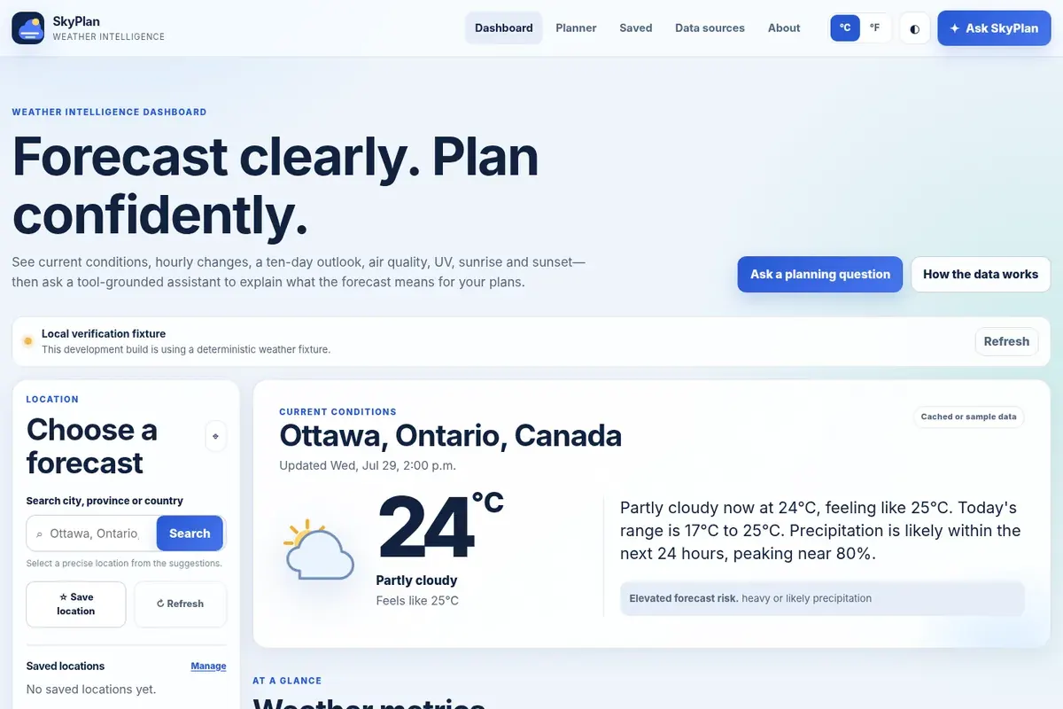
A local-first weather intelligence product combining current conditions, hourly and ten-day forecasts, saved locations, comparison, air-quality context, and grounded planning guidance.
City autocomplete, opt-in geolocation, unit controls, weather details, up to eight saved places, and two-to-three-location comparison support everyday planning.
A tool-grounded planning assistant uses normalized Open-Meteo data and retains a deterministic response when optional AI rewriting is disabled.
Problem
What needed to change
A basic weather dashboard showed raw conditions but did not help people compare places, understand broader conditions, or translate a forecast into a cautious plan.
Solution
How the release responds
Normalize several public forecast sources into an accessible local-first interface and constrain planning guidance to the retrieved weather evidence.
Key features
What visitors can use
- Current, thirty-six-hour, and ten-day forecasts
- Precipitation, air quality, UV, wind, visibility, and pressure
- Saved locations and multi-place comparison
- Opt-in geolocation and unit controls
- Tool-grounded planning assistant
Implementation
How it was built
- 01
A dependency-free generator creates eight canonical documents and an offline-capable shell.
- 02
Four functions handle health, location search, normalized weather data, and planning guidance.
- 03
Local preferences and caching keep saved places and display choices private.
Architecture
Delivery shape
Static generated pages use local preferences and four narrow Vercel Functions backed by Open-Meteo services.
Product boundary
What this release does not claim
- No official weather warnings, safety guarantees, health advice, or exact-street claims
- Planning guidance is informational and does not replace authoritative local services